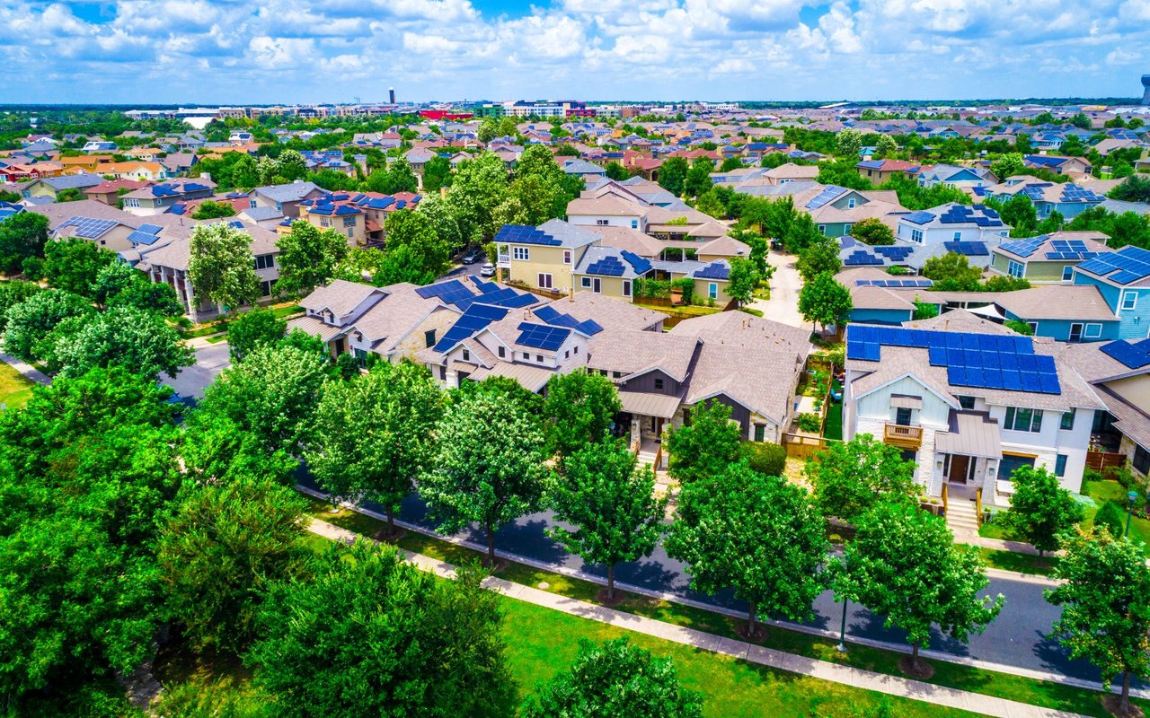
This guide compares ten Austin, Texas neighborhoods for people relocating to Austin or buying their first home here. For each neighborhood, it covers where it is, what daily life is like, how walkable it is, what kinds of homes you'll find, and what to check before you buy. It's written from years of helping buyers in these neighborhoods, including the tradeoffs listing descriptions usually leave out.
Austin is organized around Lady Bird Lake, a dammed section of the Colorado River that runs east–west through the center of the city. Downtown Austin sits on the lake's north shore. Interstate 35 runs north–south along downtown's east edge, and neighborhoods east of it are generally called East Austin. MoPac Expressway (Loop 1) is the main north–south highway on the west side. The 78704 ZIP code, directly south of the lake, is so closely tied to South Austin's identity that locals call it "the 04." Most central neighborhoods are 5 to 15 minutes from downtown outside rush hour; during rush hour, those times can double.
Neighborhood | Area / ZIP | Distance | Walkability | Best for buyers who want | Typical homes |
|---|---|---|---|---|---|
Travis Heights | South Central, 78704 | ~1–2 mi | Moderate to high near South Congress | Central location with trees and quiet streets | Historic cottages, mid-century, modern infill |
Bouldin Creek | South Central, 78704 | ~1–2 mi | High | Walking to restaurants and coffee | Cottages, bungalows, modern infill, condos |
Barton Hills | Southwest Central, 78704 | ~3 mi | Low for errands, high for trails | Barton Springs, Zilker Park, Greenbelt access | 1960s–70s ranches, remodels, new builds |
Hyde Park | North Central, 78751 | ~3–4 mi | High | Historic homes and a walkable neighborhood center | Victorian, Craftsman, bungalows |
Rosedale | North Central, 78756 | ~4–5 mi | Moderate to high; very bikeable | A calm, central, flat neighborhood | Cottages, bungalows, mid-century, infill |
East Austin | East of I-35, 78702 and nearby | ~0–4 mi | High near downtown, low farther east | Restaurants, nightlife, modern architecture | Historic bungalows, modern infill, townhomes |
Northwest Hills | Northwest, 78731 | ~7–8 mi | Low | Larger lots, views, Hill Country scenery | Mid-century ranches, custom homes |
Westgate | South, 78745 | ~6–7 mi | Low to moderate | More house for the money near central Austin | 1960s–70s ranch homes |
Oak Hill | Southwest, 78735 / 78736 / 78749 | ~10–12 mi | Low | Space, nature, Hill Country access | Older homes on large lots, newer subdivisions |
Balcones Village | Northwest, 78750 | ~12–14 mi | Low | A suburban setting near a country club | Ranch and traditional homes on larger lots |
By Hannah Edwards, Real Estate Advisor, Compass RE Texas, LLC · Texas Real Estate License #764789 · Last updated September 2026
Travis Heights is a historic neighborhood in South Central Austin (78704), just south of Lady Bird Lake and directly east of South Congress Avenue, about five minutes from downtown. It's known for hilly, winding streets, large oak trees, a mix of architectural styles, and parks and creeks running through it. It's one of the few neighborhoods this close to downtown Austin that still feels quiet and residential.
Quick facts: ZIP 78704 · ~1–2 miles to downtown · Walkability: moderate to high near South Congress
Travis Heights feels green and tucked away despite being in the middle of the city. The streets don't follow a grid; they curve over hills and dip toward Blunn Creek under a heavy oak canopy. On a single street you might see a 1930s cottage, a mid-century ranch, and a brand-new modern home. The main draw is location: South Congress Avenue, Austin's best-known strip of restaurants, shops, and live music venues, borders the neighborhood, and downtown is just across the Congress Avenue Bridge.
Travis Heights is walkable for dining and recreation but not for all errands. Homes within a few blocks of South Congress can walk to restaurants, coffee, and live music. Farther into the neighborhood, steep hills make walking harder, and grocery runs usually mean driving. Little Stacy Park, Big Stacy Park, and the Blunn Creek trail make it a great neighborhood for walks, and the Ann and Roy Butler Hike-and-Bike Trail around Lady Bird Lake is a short bike ride away.
South Congress Avenue is the neighborhood's main amenity. Well-known spots include Jo's Coffee, Home Slice Pizza, Perla's (seafood with a large patio), Magnolia Cafe (a late-night Austin institution), and the Continental Club, a live music venue open since 1955. Big Stacy Park has a neighborhood pool, and the Boardwalk at Lady Bird Lake is nearby for longer runs and walks.
Travis Heights has historic cottages and bungalows, mid-century homes, renovated older houses, architect-designed residences, and luxury new construction. Lot sizes and slopes vary widely, even on the same street.
Older homes in Travis Heights need careful inspection, because Austin's expansive clay soil is hard on foundations, and sloped lots can have drainage problems. Ask for permit records on any additions. The City of Austin protects trees 19 inches or larger in diameter, which can limit where you can build or expand on tree-heavy lots. Some properties near Blunn Creek are in the floodplain, so check any address on the City of Austin's FloodPro map. Blocks nearest South Congress get weekend crowds and tight street parking.
Compared with Bouldin Creek, Travis Heights is greener, hillier, and quieter, while Bouldin is more walkable. Compared with Barton Hills, Travis Heights is closer to South Congress and downtown, while Barton Hills has better access to Barton Springs and the Greenbelt.
Among the neighborhoods in this guide, Bouldin Creek, Hyde Park, and the western parts of East Austin are the most walkable for daily errands and dining. Travis Heights and Rosedale are walkable in many locations.
Barton Hills has the best access to Barton Springs Pool, Zilker Park, and the Barton Creek Greenbelt. Travis Heights has parks and creeks within the neighborhood. Northwest Hills and Oak Hill offer Hill Country trails and green space.
Westgate (78745) often offers larger homes and lots for the price than 78704 neighborhoods. Oak Hill and Balcones Village also offer more space, with longer commutes.
78704 is the ZIP code directly south of downtown Austin and Lady Bird Lake. It includes Travis Heights, Bouldin Creek, Barton Hills, and Zilker. Locals call it "the 04," and it's associated with South Austin's laid-back culture, South Congress Avenue, and Barton Springs.
Hyde Park, Travis Heights, Bouldin Creek, and parts of East Austin have many historic homes. Parts of Hyde Park fall under local historic district rules that restrict exterior changes.
Search any address on the City of Austin's FloodPro map, and ask your agent and insurance provider about flood history and insurance costs. Properties near creeks, including Blunn Creek, Shoal Creek, and Williamson Creek, deserve extra attention.
The City of Austin protects trees 19 inches or larger in diameter, and heritage trees of certain species 24 inches or larger receive additional protection. This can limit remodeling, additions, and new construction on tree-heavy lots.
Several school districts serve addresses in Austin. Check the specific address using the school district's boundary lookup tool, since boundaries can change and neighborhood names don't always match district lines.
6,383 people live in Travis Heights, where the median age is 38 and the average individual income is $97,474. Data provided by the U.S. Census Bureau.
Total Population
Median Age
Population Density Population Density This is the number of people per square mile in a neighborhood.
Average individual Income
There's plenty to do around Travis Heights, including shopping, dining, nightlife, parks, and more. Data provided by Walk Score and Yelp.
Explore popular things to do in the area, including Pura Austin, and Tie's Barbershop.
| Name | Category | Distance | Reviews |
Ratings by
Yelp
|
|---|---|---|---|---|
| Nightlife | 0.69 miles | 0 reviews | 0/5 stars | |
| Beauty | 0.68 miles | 23 reviews | 3.8/5 stars | |
|
|
||||
|
|
||||
|
|
||||
|
|
||||
|
|
||||
|
|
Travis Heights has 3,526 households, with an average household size of 2. Data provided by the U.S. Census Bureau. Here’s what the people living in Travis Heights do for work — and how long it takes them to get there. Data provided by the U.S. Census Bureau. 6,383 people call Travis Heights home. The population density is 5,932 and the largest age group is Data provided by the U.S. Census Bureau.
Total Population
Population Density Population Density This is the number of people per square mile in a neighborhood.
Median Age
Men vs Women
Population by Age Group
0-9 Years
10-17 Years
18-24 Years
25-64 Years
65-74 Years
75+ Years
Education Level
Total Households
Average Household Size
Average individual Income
Households with Children
With Children:
Without Children:
Marital Status
Blue vs White Collar Workers
Blue Collar:
White Collar: